Integrated ADA Compliance Reports
Form, Fit and Function

ADA Sidewalk and Curb Ramp Assessment and Compliance
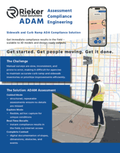
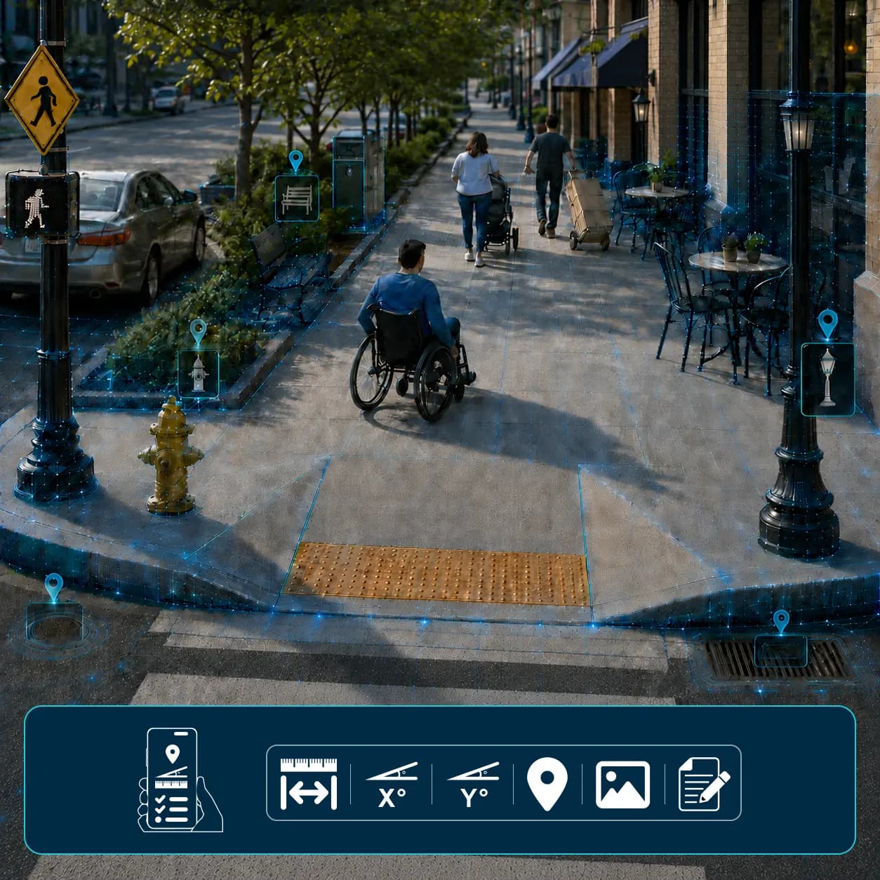
ADAM is a mobile, portal-based solution for comprehensive ADA sidewalk and curb ramp assessment, compliance, and engineering. Powered by Rieker’s proven inclinometer technology and enhanced with computer vision and web-based measurement tools, ADAM streamlines ADA compliance efforts in the public right-of-way.
From digital data capture to consistent reporting and actionable insights, ADAM offers a feature-rich, competitively priced solution that delivers exceptional value — whether you’re running a high-level survey or planning detailed remediation.
Form, Fit and Function
Detailed and Accurate
Efficient and Effective
Bring the site to you
Complete curb ramp inspections in as little as 4 minutes.
Measurements accurate down to 0.1″ (0.254cm).
National Institute of Standards and Technology (NIST) traceable calibration.
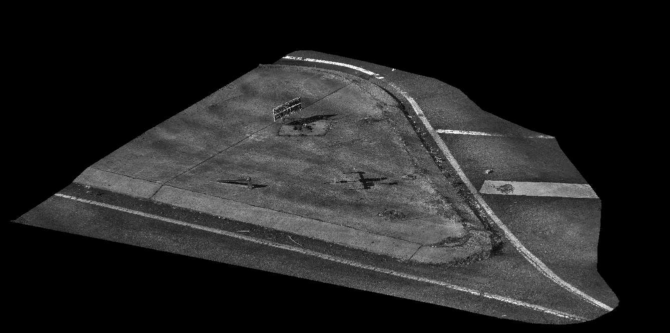
Generate a 3D model and avoid having to revisit inspection sites.
Compliance Reporting
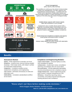
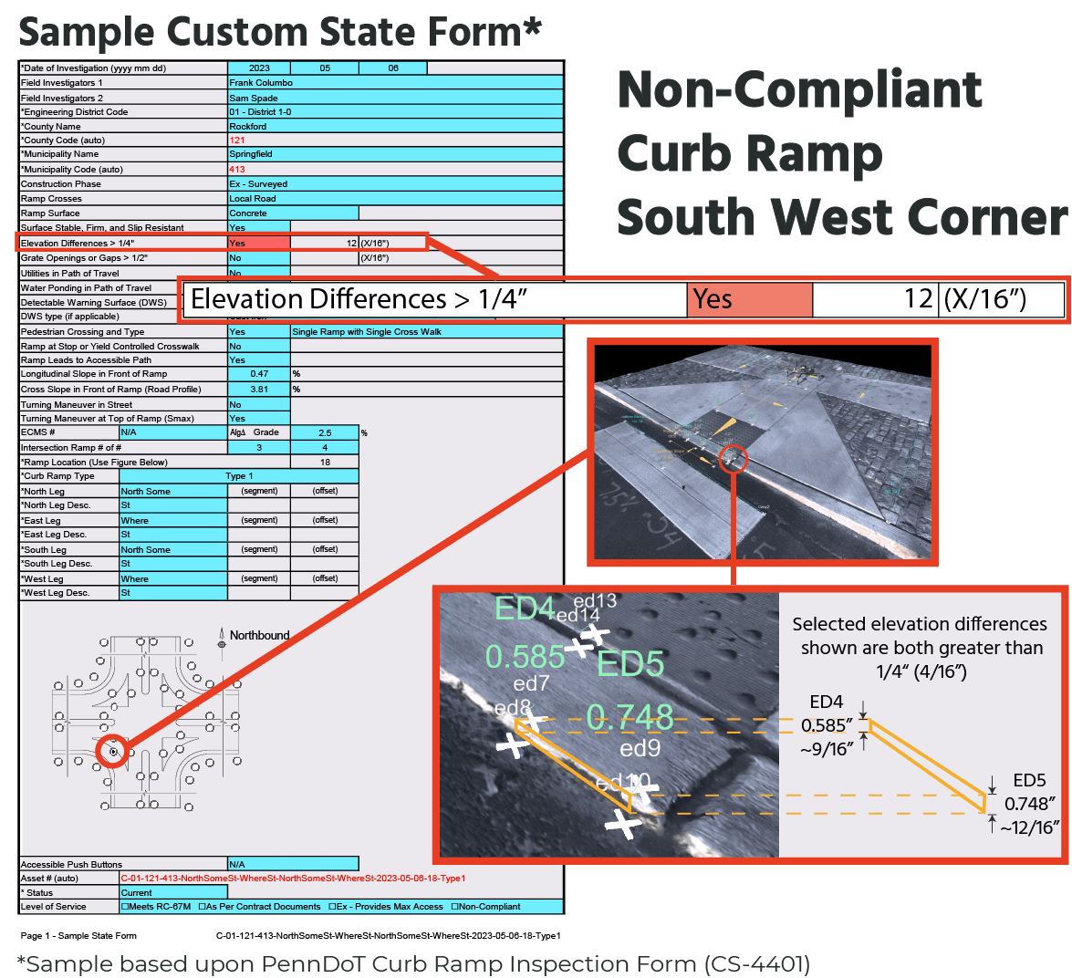
ADAM is a powerful, easy-to-use ADA sidewalk safety and curb ramp assessment and compliance solution. Combining precision hardware with intuitive, web-based software, ADAM streamlines digital inspections, measurements, reporting, and job management. Guided workflows align with standard ADA requirements, state-specific measurements, and evolving regulations such as MUTCD and PROWAG. Populate state-compliant curb ramp reports with consistent, highly accurate data.
Portal Software Suite
ADAM’s Sidewalk Assessment Tool enables a detailed review of 3D digital infrastructure models for sidewalks, ADA curb ramps, surface conditions, obstacles, and ADA technical infeasibilities. Used in Compliance assessments, these data-rich 3D models deliver comprehensive ADA compliance analysis and reporting.
For quick evaluations, ADAM’s tools support in-field measurement and data processing directly from the jobsite — no complex post-processing required. When deeper analysis is needed, Compliance workflows bring the site to your desktop with highly accurate models (up to 0.1″ resolution) that eliminate costly return visits.
Easily save and share model views with embedded measurement points for collaboration with third-party stakeholders, archiving, and defensible ADA documentation.
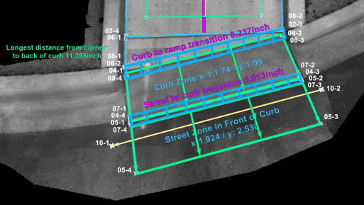
Reliable and accurate measurements
Varying elevations shown along the transition
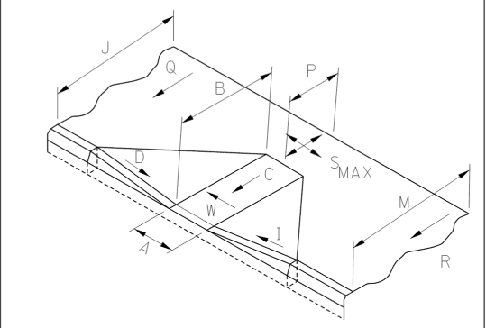
Sample Measurement Guide
Get all required measurements from the 3D digital model
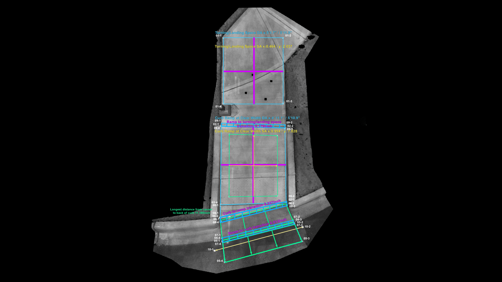
3D Measured. ADA Compliance Verified.
Complete 3D modeling and compliance measurement ensure you have trusted, accurate data to confirm compliance — or identify the exact extent of remediation needed.
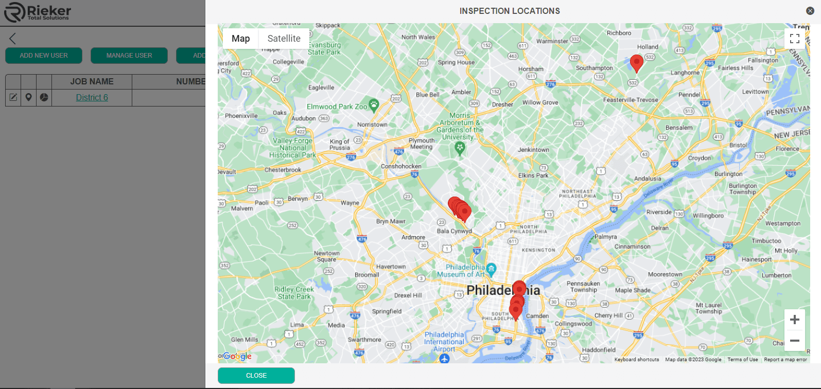
Online job management tools to effectively organize, schedule, view, monitor, and download files for use in 3rd party software.
Gain insight, oversight, and easily retrieve, export, and archive inspection records.
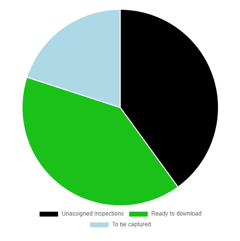
Monitor your progress toward the ADA sidewalk inspection checklist and ADA curb ramp compliance.
Design & Engineering
Unlike other inspection processes and technologies, ADAM provides a 3D infrastructure model — the physical site’s digital twin — that is exceptionally detailed and accurate. View, assess, and measure obstacles, technical infeasibilities, slopes, distances, and elevations. Downloadable and shareable in various file formats and units of measurement, these digital assets save time, effort, and money when (re)design or engineering is needed. LAS file export supports inches, feet, or meters in full or reduced resolution as preferred, and converts to digital elevation maps in minutes.
With over 100 years of leadership, engineering excellence, and innovation, Rieker delivers trusted solutions for complex infrastructure challenges—expertise that forms the foundation of its Advanced Data Acquisition and Measurement (ADAM) solution.
ADAM combines specialized hardware and advanced software to capture highly accurate 3D digital infrastructure models, enabling precise measurement, analysis, and compliance verification with reliable data for informed decision-making.
ADAM leverages Rieker's proven inclinometer (H6 Flex Series) technology to automatically determine and set a zero reference plane. The automated reference plane (ARP) equipment includes parts manufactured and calibrated to meet National Institute of Standards and Technology (NIST) certification standards.
Created with Rieker's expertise in computer vision tools and techniques and integrated with global positioning system (GPS) technology, the result is a location-specific, highly detailed, and accurate 3D digital infrastructure model enabling NIST traceable measurement, analysis, and reporting.
Using the Model Analysis Tool (sidewalk inspection software) included with ADAM, measurements made on the model (the 3D digital site twin) are consistent, repeatable, and NIST traceable. As needed, model views including all measurements can be saved and shared with 3rd party stakeholders and exported in various file formats for use (import) in 3rd party software.
ADAM also includes a Job Management Tool (sidewalk inspection software) that enables scheduling with due dates, categorization (grouping), mapping, assignment, and monitoring of job status.
Watch a quick (2 min) demo of the ADAM Assessment, Compliance and Engineering Modules + see how the Job Management tools improve workflow and success.
Job Management is an important activity toward ADA sidewalk inspection programs and curb ramp compliance. This video introduces the many features included in Rieker's ADAM tool.
ADAM combines advanced data capture—including 3D digital modeling—with powerful online reporting tools to support guided and customized ADA curb ramp compliance documentation. Generate accurate, repeatable, NIST-traceable measurements and populate state-compliant reports aligned with local guidelines.
Learn how Advanced Data Acquisition and Measurement (ADAM) from Rieker Inc. is a comprehensive ADA sidewalk safety assessment and curb ramp risk assessment, compliance, and engineering solution. With integrated inspection tools, customizable reporting, and a 5-minute, data-rich 3D model capture, ADAM delivers definitive proof of compliance using consistent, verifiable data.
Assess sidewalks and curb ramps with ease. Capture GPS-tagged objects, distances, and dual-axis slope data — all from your mobile device. This brief, sound-free video demonstrates how quickly and accurately sidewalk and curb-ramp data is captured with the ADAM App.
Experience next-level ADA curb-ramp compliance. With 3D photogrammetric modeling, advanced analysis tools, and integrated report generation, ADAM Compliance makes data capture and reporting faster and more reliable than ever.
Generate high-precision 3D models and LAS files in your preferred measurement unit and density — with optional textured mesh and orthographic outputs. Measurement Validation Plates enable precise tie-ins when placed beside known reference points or monuments within the capture area.